
Regional Haze
The Regional Haze Program works to protect the clean, clear views in America’s national parks, forests, and wilderness areas. These places, called Class I areas, are valued for their natural beauty, and haze from air pollution can make it harder to see them. Nevada’s work in this program focuses on the Jarbidge Wilderness Area in the northeast part of the state, Nevada’s only Class I area.
History
Congress took the first big step in 1977 by updating the Clean Air Act. Lawmakers set a national goal: prevent future visibility problems and fix existing ones caused by human made air pollution. In 1979, the U.S. Environmental Protection Agency (EPA) created a list of 156 Class I areas across the country.
In 1999, EPA created the Regional Haze Rule. This rule lays out a long term plan — about 60 years — to help all Class I areas move toward natural visibility conditions by the year 2064. States must create a State Implementation Plan (SIP) that explains how they will improve visibility on the haziest days and protect the clearest days. States must also look at how haze moves across borders, because air pollution does not stay in one place.
- Visit Regional Haze Program | US EPA (external link)
- Visit Visibility and Regional Haze | US EPA (external link)
Approximately every ten years, states must update their SIP. During the first planning period, states had to review older facilities and decide whether each needed “Best Available Retrofit Technology,” or BART. States also study where haze comes from — both natural sources like wildfire and dust storms, and human sources like vehicles, industry, and power plants.
Nevada worked with many western states, tribes, and federal agencies through a group called the Western Regional Air Partnership (WRAP). WRAP helps develop the science and tools that western states need to meet regional haze requirements.
Photo Gallery
Figure 1. Class I Wilderness Areas in and near Nevada
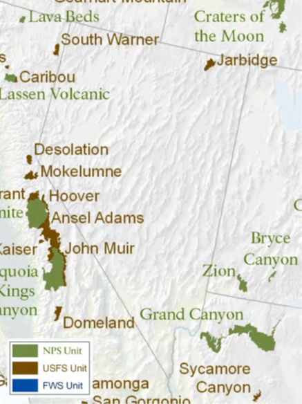
Figure 2. Mary River's Peak in the Jarbidge Wilderness Area during a fire event
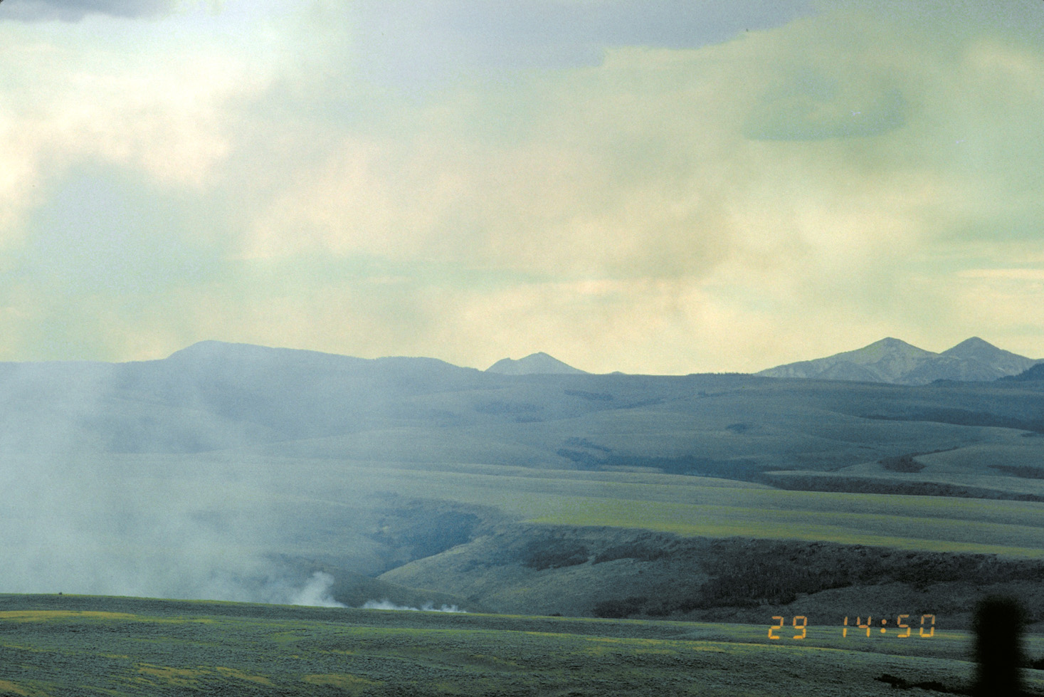
Figure 3. Mary River's Peak in the Jarbidge Wilderness Area during a haze event
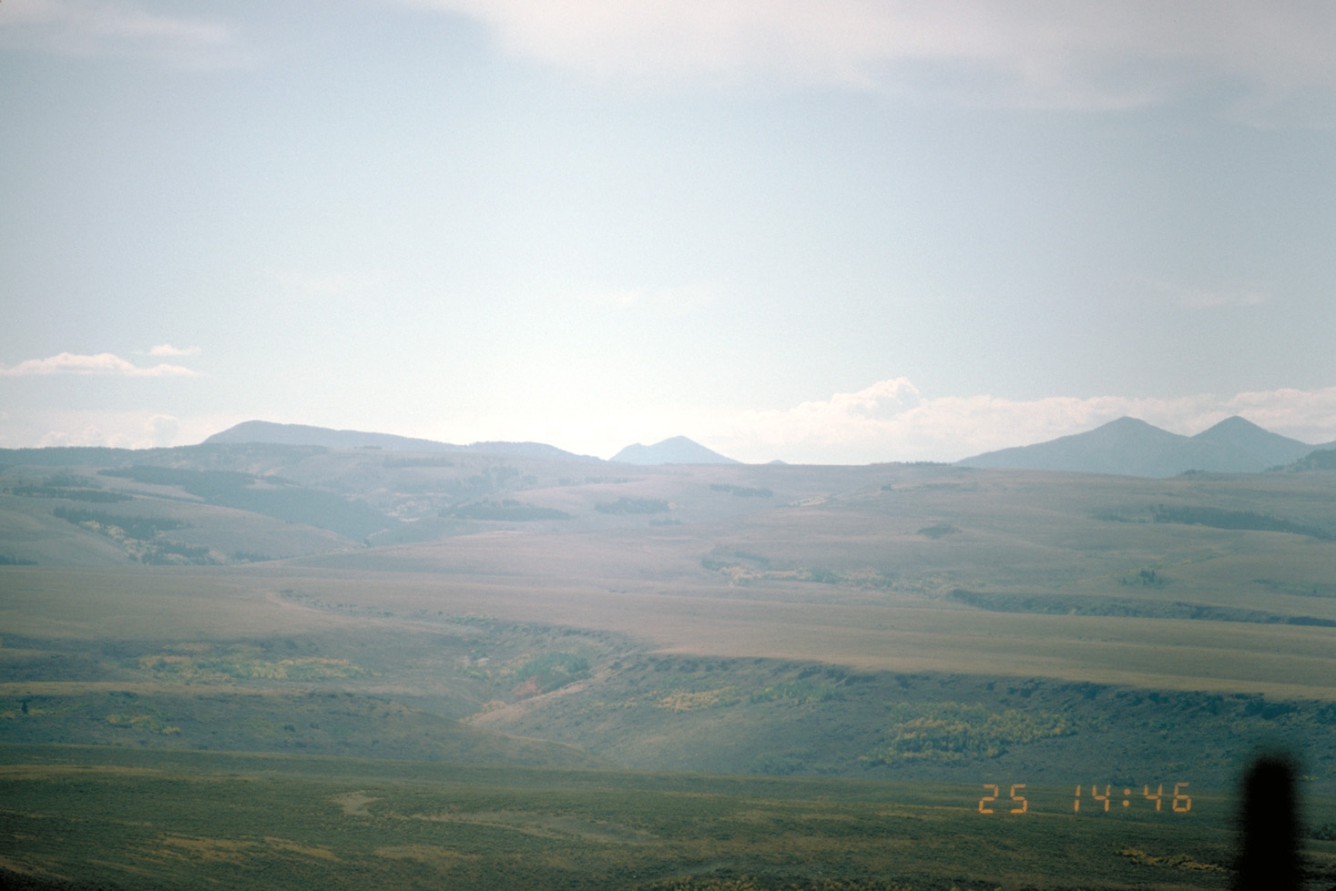
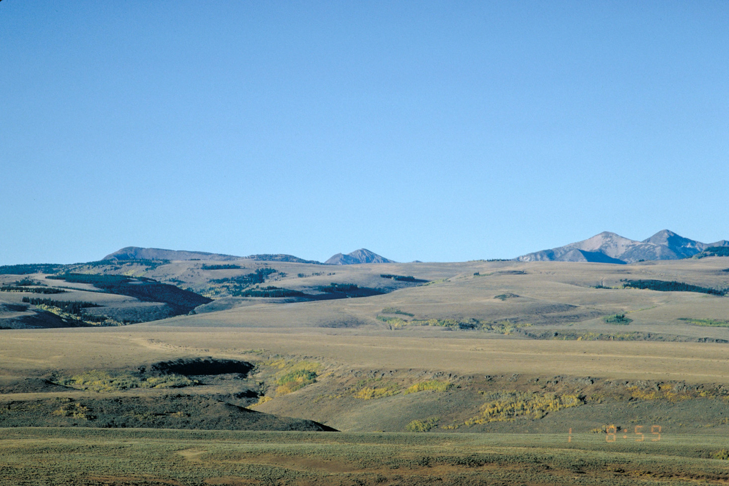
Figure 4. Mary River's Peak in the Jarbidge Wilderness Area during a clear day in the summer season
Nevada's Regional Haze Planning
2009 Regional Haze State Implementation Plan
Nevada submitted its first Regional Haze State Implementation Plan (SIP) to address visibility protection in the Jarbidge Wilderness Area. This plan covered the initial planning period and outlined the strategies the state would use to reduce haze.
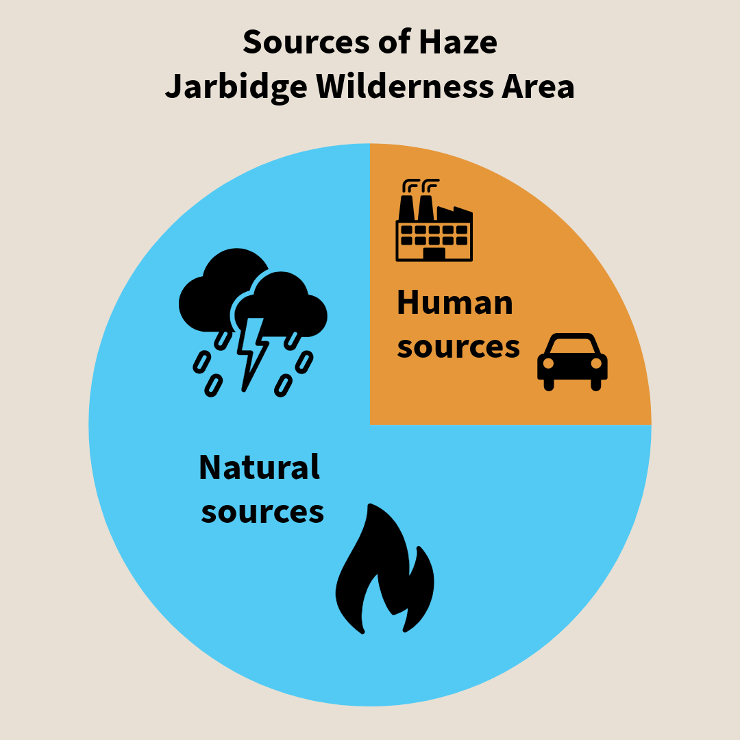
Studies for the 2009 SIP showed that most visibility impacts at Jarbidge are caused by natural sources, including wildfire smoke and windblown dust. Nevada’s human‑caused contribution is relatively small. Even so, Nevada required several older power‑generating units to install and operate Best Available Retrofit Technology (BART). These controls, along with other Clean Air Act requirements, help reduce emissions and support visibility improvements in Nevada and in nearby Class I areas.
Figure 5. Sources of haze at Jarbidge Wilderness Area
2014 Regional Haze Progress Report
In 2014, Nevada submitted a five year progress report. It showed that the state was on track to meet its goals for 2018, and that no major changes to the 2009 plan were needed. By this time, several older units at the Reid Gardner Generating Station had permanently shut down, which also helped lower pollution levels.
2022 Regional Haze State Implementation Plan
The 2022 Regional Haze SIP demonstrates continued progress toward clearer air. NDEP evaluated visibility conditions for both the most impaired days and the clearest days, comparing baseline, current, and natural conditions.
Key findings include:
- Visibility on the most impaired days has steadily improved since the initial planning period.
- Current visibility on the clearest days has not degraded.
- Data show that haze at Jarbidge is influenced by both natural sources (wildfire smoke and windblown dust) and human caused emissions.
- Overall trends indicate that visibility conditions remain on track toward long term natural conditions.
2025 Regional Haze SIP Revision
Nevada updated portions of the Regional Haze plan to reflect changes in the state’s energy system and power‑generation planning. NV Energy announced plans to modify operations and install appropriate controls at the Tracy and North Valmy generating stations. Because these facilities were included in the 2022 Regional Haze SIP, NDEP withdrew the portions affected by those changes and completed new technical reviews.
The revision includes:
- A four‑factor analysis for the North Valmy Generating Station and Tracy Unit 4.
- Updated reasonable progress requirements for the current planning period.
- Incorporation of updated permits for the Lhoist Apex and Graymont Pilot Peak facilities.
This revision replaces the withdrawn elements from the 2022 SIP and updates Nevada’s visibility improvement strategy accordingly.
2025 Regional Haze Progress Report
The Progress Report evaluates Nevada’s status midway through the current Regional Haze planning period.
Key findings:
- Some required emission reductions have not yet been fully realized because certain control measures depend on approval of the Regional Haze plan updates.
- Emissions in Nevada have declined during the planning period, based on national inventory and market data.
- Visibility in the Jarbidge Wilderness Area has shown a slight decline in recent years, likely related to increased wildfire activity and windblown dust.
- Despite this short‑term change, Jarbidge still shows a net improvement from baseline conditions.
- With expected future reductions from approved control strategies, Nevada’s Regional Haze SIP and the 2025 revision remain adequate to meet reasonable progress goals for this planning period.
Looking ahead
The EPA has extended the start of the third planning period to the summer of 2031.
Regional Haze Documents
First planning period
Nevada 2009 Regional Haze State Implemntation Plan (SIP)
- Download 2009 Regional Haze SIP
- Download 2009 Appendices
- Download 2009 NDEP cover letter to EPA with attachments
Nevada 2014 Regional Haze Progress Report
Second planning period
Nevada 2022 Regional Haze SIP
- Download 2022 Regional Haze SIP Transmittal Letter
- Download 2022 Regional Haze SIP
- Download 2022 Regional Haze SIP - Appendix A
- Download 2022 Regional Haze SIP - Appendix B Part 1
- Download 2022 Regional Haze SIP - Appendix B Part 2
- Download 2022 Regional Haze SIP - Appendix B Part 3
- Download 2022 Regional Haze SIP - Appendix C through J
- Download 2022 Regional Haze Clarification Letter
Nevada 2025 Regional Haze SIP Revision
Nevada 2025 Regional Haze Progress Report
BART Determinations
Four Generating Stations in Nevada, comprising 10 units, are subject to Best Available Retrofit Technology (BART):
- NV Energy's generating stations at Tracy (units 1, 2 and 3)
- Fort Churchill (units 1 and 2)
- Reid Gardner (units 1, 2 and 3)
- Southern California Edison's (SCE) Mohave Generating Station (units 1 and 2)
NV Energy facilities BART Determination Reports
- Download Tracy BART Review and Determination
- Download Fort Churchill BART Review and Determination
- Download Reid Gardner BART Review and Determination
Southern California Edison (SCE) BART Determination Report
Federal Register Notices
The Federal Register is the official journal of the federal government of the United States that contains government agency rules, proposed rules, and public notices.
- Download June 22, 2011, FR Nevada; Regional Haze State Implementation Plan. Proposed Rule.
- Download March 26, 2012, FR Nevada; Regional Haze Implementation Plan. Final Rule.
- Download April 12, 2012, FR Nevada; Regional Haze State and Federal Implementation Plans; BART Determination for Reid Gardner Generating Station. Proposed Rule.
- Download August 23, 2012, FR Nevada; Regional Haze State and Federal Implementation Plans; BART Determination for Reid Gardner Generating Station. Final Rule.
- Download March 26, 2013, FR Nevada; Regional Haze Federal Implementation Plan; Reconsideration of BART Compliance Date for Reid Gardner Generating Station. Proposed Rule; Notice of Reconsideration of Final Rule.
- Download August 28, 2013, FR Nevada; Regional Haze Federal Implementation Plan; Extension of BART Compliance Date for Reid Gardner Generating Station. Final Rule.
- Download September 17, 2015, FR Nevada; Regional Haze Progress Report. Proposed Rule.
- Download August 8, 2017, FR Nevada: Regional Haze Progress Report. Final Rule.
- Download October 23, 2025, Nevada; Regional Haze SIP for the Second Implementatin Period. Proposed Rule.
- Download February 06, 2026, Nevada; Regional Haze SIP for the Second Implementation Period. Final Rule.